
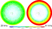
How neat is this? Back in 2013, one of our customer service agents found a PDF listing every satellite in the sky at the time it was published in 2006. It shows the dominance that Boeing has in the satellite launch industry. It’s a little dated but it still gives you a lot of information. If anyone has a later map, it would be great to see… just leave a link in the comments and I’ll attach it permanently to this article.
Before 1962…
It’s amazing to think that a little over 50 years ago, there were precisely zero communications satellites in the sky, when now there are hundreds. That first satellite, Telstar 1, was built by AT&T of course. They’ve been satellite TV pioneers longer than anyone else.
Looking at that satellite, which was designed to carry a few black-and-white transmissions, makes you realize how far we’ve come. It also makes you think about the effort that it takes to get a satellite up to geosynchronous orbit, and the massive cost involved.
Of course, this map makes the sky look crowded but the exact opposite is true. There are hundreds of miles of space between satellites, and international and domestic agencies cooperate to make sure that stays true. After all, a satellite that crashes into another satellite is generally a complete loss. Every satellite in the sky today is kept in a specific orbit using on-board fuel. Before that fuel is exhausted, it’s moved to a much higher orbit where it can sit. It will stay there, indefinitely, until we come up with a cheap way to bring it down safely.
The miracle of communications satellites
OK, “miracle” is a bit of a strong word. It’s really a lot of math and physics. There’s a good deep dive article here, but it boils down to one basic thing. When you put something in orbit around a planet, it moves slower as it gets further away. That means, there’s a point where it will be going exactly the same speed as the planet itself. On Earth, in order to make one full orbit in 24 hours, a satellite needs to be roughly 22,000 miles away from the surface. That’s where all the communications satellites live. That orbit makes it seem like they’re hovering in space just above one point. Because they don’t move relative to what’s below them, it’s possible to point an antenna (a satellite dish) at them easily.
That simple-sounding bit of explanation has made most of our modern world possible, which is pretty amazing
The satellite fleet, visualized
Take a look at the map:
If you’d like a closer look at this map, click here.


Great information!
The following link from Boeing shows a newer chart (2010) with 294 commercial satellites:
https://secure.boeingimages.com/archive/Commercial-Communications-Satellites-Orbit-2F3XC5KQCM9.html#/SearchResult&ITEMID=2F3XC5KQCM9
Maybe someone can provide the one for 2018 in pdf format.